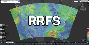
52°27'Β / 125°18'Δ / Υψόμετρο 1097 m / 00:42 11/11/2026, America/Vancouver (UTC-7)


από τις: 11/11/2026, 00:10
προς την: 11/11/2026, 16:22
Orange warning - wind - in effect Damaging winds are expected. What: Strong and damaging southeasterly winds are expected. When: Overnight until Wednesday afternoon. Where: Chilcotin - South of Highway 20 including Tatlayoko Lake, Big Creek and Dog Creek. Additional Information: Another strong and slow moving frontal system will lie across central B.C. tonight through Wednesday. Southeasterly wind will increase to 30 km/h gusting to 50 near noon, then strengthen further Wednesday morning with gusts to 80 km/h. Winds will continue to increase to 60 km/h gusting to 100 or more through Wednesday afternoon before easing Wednesday evening. ### Utility outages are likely. Driving conditions will likely be very difficult. There is a risk of injury due to flying or falling debris. Wind warnings are issued when there is a significant risk of damaging winds. Please continue to monitor alerts and forecasts issued by Environment Canada. To report severe weather, send an email to [email protected] or post reports on social media using #BCStorm.
 Chilcotin
 Secure loose objects. Stay away from fallen power lines. Prepare for some disruptions to transportation, services, and utilities.
 Environment Canada
 11/11/2026, 00:22


από τις: 10/11/2026, 23:00
προς την: 11/11/2026, 08:50
Yellow warning - rainfall - in effect Heavy rain is expected. Where: Chilcotin near the Coastal Mountains. When: Tonight through Wednesday. Additional Information: An approaching frontal system will stall over the Chilcotin region tonight. It will bring 50 to 80 mm of rainfall to the western sections of Chilcotin by end of Wednesday evening. ### Water will likely pool on roads and in low-lying areas. Some property damage is possible. Rainfall warnings are issued when significant impacts are expected due to rainfall amounts. Please continue to monitor alerts and forecasts issued by Environment Canada. To report severe weather, send an email to [email protected] or post reports on social media using #BCStorm.
ChilcotinAvoid low-lying areas. Watch for washouts near rivers, creeks and culverts.Environment Canada10/11/2026, 16:50