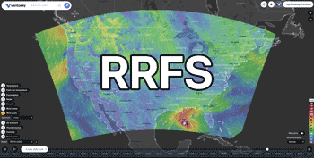
43°25'N / 123°12'W / Altitude 188 m / 15:13 2026/11/22, America/Los_Angeles (UTC-8)


From: 2026/11/22, 12:20
To: 2026/11/23, 04:30
* WHAT...South winds 25 to 40 mph with gusts up to 65 mph expected. * WHERE...Curry County Coast and South Central Oregon Coast, including exposed areas of Highway 101. * WHEN...From 4 PM Monday to 7 PM PST Tuesday. * IMPACTS...Damaging winds will blow down trees and power lines. Widespread power outages are expected. Travel will be difficult, especially for high profile vehicles. * ADDITIONAL DETAILS...Winds are expected to be strongest late Tuesday morning through early Tuesday afternoon. Wind gusts could reach 75 mph on coastal headlands, including Cape Blanco and Cape Sebastian.
 Douglas
 Winds this strong can make driving difficult, especially for high
profile vehicles. Use extra caution.
People are urged to secure loose objects, including large or
inflatable holiday decorations that could be blown around or damaged
by the wind.
 NWS Medford OR
 2026/11/22, 12:20

From: 2026/11/22, 13:33
To: 2026/11/23, 04:00
* WHAT...For the Coastal Flood Advisory, higher than normal astronomical tides (King Tides) are expected to bring up to 2.4 ft of inundation above ground level in low-lying areas near shorelines and tidal waterways on Monday. For the Coastal Flood Warning, higher than normal astronomical tides (King Tides) combined with storm surge from large surf are expected to bring up to 3.1 ft of inundation above ground level Tuesday and Wednesday, with up to 2.6 ft of inundation expected on Thursday. * WHERE...Beaches and low lying areas along the shore lines of Douglas, Coos and Curry Counties. This includes the communities of North Bend, Charleston, Port Orford, Gold Beach, and Coos Bay. Coastal flooding is expected to impact portions of Highway 101 around Gold Beach, Coos Bay, and Reedsport. * WHEN...For the Coastal Flood Advisory, from 7 AM to 4 PM PST Monday. For the Coastal Flood Warning, from 7 AM Tuesday to 7 PM PST Thursday. * IMPACTS...Numerous roads may be closed. Low lying property including homes, businesses, and some critical infrastructure will be inundated. Some shoreline erosion will occur. This event is expected see similar impacts to what occurred on January 3rd, 2026. * ADDITIONAL DETAILS...The worst conditions are expected to be during the high tide periods in the late morning/early afternoon. This is especially so for Tuesday and Wednesday as storm activity brings large breaking surf heights of 23 to 28 ft and adds storm surge to the water levels. Storm activity lessens on Thursday, but King Tides will still be present, which will likely continue inundation impacts. At the Charleston, OR tide gauge, high tide is expected to be at 10:09 AM Monday, at 10:51 AM Tuesday, at 11:35 AM Wednesday, and at 12:23 PM Thursday.
DouglasTake the necessary actions to protect flood-prone property. If
travel is required, do not drive around barricades or through
water of unknown depth.NWS Medford OR2026/11/22, 13:33
From: 2026/11/22, 13:33
To: 2026/11/23, 04:00
* WHAT...For the Coastal Flood Advisory, higher than normal astronomical tides (King Tides) are expected to bring up to 2.4 ft of inundation above ground level in low-lying areas near shorelines and tidal waterways on Monday. For the Coastal Flood Warning, higher than normal astronomical tides (King Tides) combined with storm surge from large surf are expected to bring up to 3.1 ft of inundation above ground level Tuesday and Wednesday, with up to 2.6 ft of inundation expected on Thursday. * WHERE...Beaches and low lying areas along the shore lines of Douglas, Coos and Curry Counties. This includes the communities of North Bend, Charleston, Port Orford, Gold Beach, and Coos Bay. Coastal flooding is expected to impact portions of Highway 101 around Gold Beach, Coos Bay, and Reedsport. * WHEN...For the Coastal Flood Advisory, from 7 AM to 4 PM PST Monday. For the Coastal Flood Warning, from 7 AM Tuesday to 7 PM PST Thursday. * IMPACTS...Numerous roads may be closed. Low lying property including homes, businesses, and some critical infrastructure will be inundated. Some shoreline erosion will occur. This event is expected see similar impacts to what occurred on January 3rd, 2026. * ADDITIONAL DETAILS...The worst conditions are expected to be during the high tide periods in the late morning/early afternoon. This is especially so for Tuesday and Wednesday as storm activity brings large breaking surf heights of 23 to 28 ft and adds storm surge to the water levels. Storm activity lessens on Thursday, but King Tides will still be present, which will likely continue inundation impacts. At the Charleston, OR tide gauge, high tide is expected to be at 10:09 AM Monday, at 10:51 AM Tuesday, at 11:35 AM Wednesday, and at 12:23 PM Thursday.
DouglasTake the necessary actions to protect flood-prone property. If
travel is required, do not drive around barricades or through
water of unknown depth.NWS Medford OR2026/11/22, 13:33