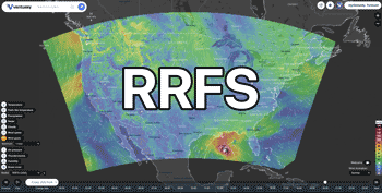
13°30'N / 144°50'E / Altitude 87 m / 20:33 2026/10/16, Pacific/Guam (UTC+10)


From: 2026/10/16, 16:11
To: 2026/10/17, 00:15
...TROPICAL STORM CHAMPI MOVING RAPIDLY WEST ON APPROACH TO THE MARIANAS... ...CHAMPI LIKELY TO MOVE NEAR GUAM AND ROTA AS A TYPHOON... .NEW INFORMATION... A Typhoon Warning has been issued for Guam, Rota, and the adjacent waters. A Tropical Storm Warning has been issued for Tinian, Saipan, and the adjacent waters. .AREAS AFFECTED... This local statement provides information and recommended action for people on Guam, and people on Rota, Tinian and Saipan in the Commonwealth of the Northern Marianas. .WATCHES/WARNINGS... A Typhoon Warning is in effect for Guam and Rota. A Tropical Storm Warning is in effect for Tinian and Saipan. A Typhoon Watch continues for Tinian and Saipan. A Flood Watch is in effect for all of Guam and the Northern Marianas. Please listen closely for any Flood Warnings that might be in effect for your area. Please check the latest public and marine forecasts for detailed information about additional hazards. .STORM INFORMATION... At 200 PM ChST, the center of Tropical Storm Champi (29W) was located near latitude 11.4N and longitude 153.3E, about 300 miles north- northeast of Chuuk and about 590 miles east-southeast of Guam. Storm motion was west, 265 degrees, at 24 mph. Storm intensity was 50 mph. Champi will continue on this trajectory and slow down as it continues barreling toward the Marianas. This general forecast track will take Champi close to, or over, Guam Sunday morning. Champi is forecast to continue intensifying over the next few days, likely becoming a typhoon by Saturday. .SITUATION OVERVIEW... Mostly benign conditions are expected across the Marianas tonight, followed by a steady increase in showers and winds Friday afternoon, and then deteriorating significantly coming into Saturday night as Tropical Storm Champi continues to move in from the east-southeast. Champi is expected to go through a period of rapid intensification over the next 24 hours, becoming a typhoon by Saturday and strengthening further thereafter. Winds and rain will come in rapidly, with winds becoming dangerous and life threatening very soon after onset. Do not let a false sense of normalcy now dictate your actions tomorrow; prepare NOW!
 Guam,Guam
 Take small loose objects indoors. Identify suitable shelter. Stock up
a few days worth of food and water. If no concrete shelter is
available look for a cave or something similar. Take action to
protect food crops or other possessions as appropriate.
Take small loose objects indoors. Identify suitable shelter. Stock up
a few days worth of food and water. If no concrete shelter is
available look for a cave or something similar. Take action to
protect food crops or other possessions as appropriate. NWS Tiyan GU
 2026/10/16, 16:11

From: 2026/10/16, 14:31
To: 2026/10/17, 15:45
* WHAT...Flooding caused by excessive rainfall continues to be possible. * WHERE...Guam, Rota, Saipan and Tinian. * WHEN...Through Sunday afternoon. * IMPACTS...Excessive runoff may result in flooding of rivers, creeks, streams, and other low-lying and flood-prone locations. Flooding may occur in poor drainage and urban areas. Storm drains and ditches may become clogged with debris. Extensive street flooding and flooding of creeks and rivers are possible. * ADDITIONAL DETAILS... - Tropical Storm Champi is approaching the Marianas and will bring torrential rain Saturday night and Sunday at least. Total rainfall accumulations of 12 to 20 inches are possible for Guam, 10 to 18 inches for Rota and 8 to 12 inches for Tinian and Saipan. This could cause flooding problems in poor drainage and flood prone areas. - http://www.weather.gov/safety/flood
Guam,GuamYou should monitor later forecasts and be prepared to take action
should Flash Flood Warnings be issued.NWS Tiyan GU2026/10/16, 14:31

From: 2026/10/16, 15:12
To: 2026/10/16, 23:00
* WHAT...For the High Surf Warning, dangerously large breaking waves of 7 to 9 feet Saturday afternoon, building to as high as 26 feet for Guam, 20 feet for Rota and 19 feet for Tinian and Saipan. For the Coastal Flood Watch, significant coastal flooding possible. * WHERE...For the High Surf Warning, initially east facing reefs of Guam, Rota, Tinian and Saipan; spreading to south facing reefs through Sunday afternoon. For the Coastal Flood Watch, all reefs of the Marianas. * WHEN...For the High Surf Warning, from 5 PM Saturday to 4 AM ChST Monday. For the Coastal Flood Watch, from Saturday afternoon through late Sunday night. * IMPACTS...Numerous roads may be closed. Low lying property including homes, businesses, and some critical infrastructure may be inundated. Some shoreline erosion may occur. Breaking waves can sweep people off jetties and docks, and into dangerous seas. Life- threatening swimming conditions and significant beach erosion can be expected. Coastal inundation of up to 5 feet for Guam, 2 to 4 feet for Rota and 1 to 3 feet for Tinian and Saipan is possible. Coastal flooding and beach erosion is possible. * ADDITIONAL DETAILS...As TS Champi approaches the Marianas, surf conditions are expected to deteriorate rapidly, with surf reaching 9 feet Saturday afternoon, building to dangerous/deadly levels through Saturday night.
Guam,GuamEveryone should remain out of the water due to life-threatening
surf conditions. Stay off of jetties, piers, and other waterside
infrastructure.NWS Tiyan GU2026/10/16, 15:12From: 2026/10/16, 15:12
To: 2026/10/16, 23:00
* WHAT...For the High Surf Warning, dangerously large breaking waves of 7 to 9 feet Saturday afternoon, building to as high as 26 feet for Guam, 20 feet for Rota and 19 feet for Tinian and Saipan. For the Coastal Flood Watch, significant coastal flooding possible. * WHERE...For the High Surf Warning, initially east facing reefs of Guam, Rota, Tinian and Saipan; spreading to south facing reefs through Sunday afternoon. For the Coastal Flood Watch, all reefs of the Marianas. * WHEN...For the High Surf Warning, from 5 PM Saturday to 4 AM ChST Monday. For the Coastal Flood Watch, from Saturday afternoon through late Sunday night. * IMPACTS...Numerous roads may be closed. Low lying property including homes, businesses, and some critical infrastructure may be inundated. Some shoreline erosion may occur. Breaking waves can sweep people off jetties and docks, and into dangerous seas. Life- threatening swimming conditions and significant beach erosion can be expected. Coastal inundation of up to 5 feet for Guam, 2 to 4 feet for Rota and 1 to 3 feet for Tinian and Saipan is possible. Coastal flooding and beach erosion is possible. * ADDITIONAL DETAILS...As TS Champi approaches the Marianas, surf conditions are expected to deteriorate rapidly, with surf reaching 9 feet Saturday afternoon, building to dangerous/deadly levels through Saturday night.
Guam,GuamEveryone should remain out of the water due to life-threatening
surf conditions. Stay off of jetties, piers, and other waterside
infrastructure.NWS Tiyan GU2026/10/16, 15:12

From: 2026/10/13, 17:31
To: 2026/10/17, 10:15
ESFGUM This Hydrologic Outlook is for Guam, Rota, Tinian, and Saipan. Invest 96W is still a broad, disorganized disturbance located about 300 miles north of Kosrae. Ensemble model guidance continues to show a passage anywhere between south of Guam to north of Saipan as a tropical storm or typhoon. Uncertainty is still high regarding timing, location, and intensity, but the potential for locally heavy rainfall and flooding continues to increase approaching this weekend. This is expected to produce 5 to 8 inches of rainfall between Saturday and Monday, with localized amounts up to 12 inches possible. As showers are likely to persist, consistent rainfall is likely to saturate the soils enough to increase chance for mudslides. Residents on these islands need to closely monitor this developing situation as flood watches, advisories and flash flood warnings could be issued later this weekend. If living near streams and rivers, prepare to move items away from stream and river banks. Make sure storm drains nearby are not clogged, especially If living at low-lying areas.
GuamNWS Tiyan GU2026/10/13, 17:31